Brazil is the largest and most populous country in South America, with a population of 200 million people where Portuguese is the country's official language. It's renowned for a variety of reasons, some of which you're probably already aware of.
So, what are the Brazil tourist places, you might ask? Of fact, in many ways, our country's illustrious reputation precedes it. This is the land of gorgeous people, magnificent beaches like Copacabana and Ipanema, and great soccer stars like Pelé. Oh, and every year, there's a tiny festival called Carnival, which overflows into the streets in a statewide display of colour and culture. But did you know that Brazil is home to a plethora of undulating mountains, volcanic hills, shell-mountains, and massifs? Some can be climbed, while others cannot, and one of them is an active volcano. Given below is the list of the mountains that you should visit and include in your Brazil tour package itinerary.
1. Sugarloaf Mountain
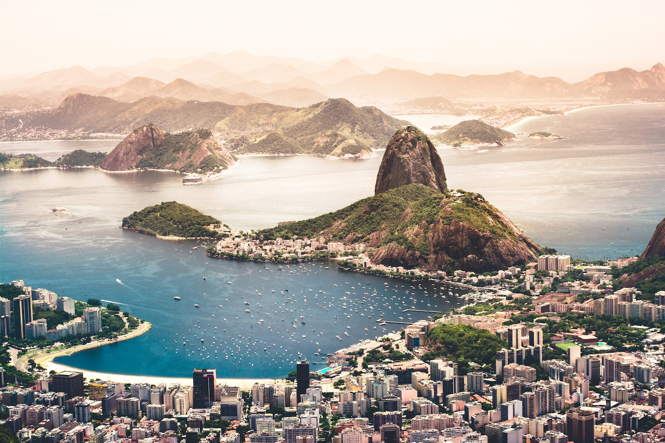
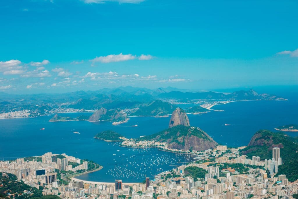
Sugarloaf Mountain in Brazil, along with gorgeous beaches and perfect bodies, carnival, and caipirinhas, is one of Rio's most lasting symbols—and rightly so.
The massive, dome-shaped mountain, which stands about 1,300 feet tall, towers over the famed beaches of Copacabana and Ipanema, the entrance of Guanabara Bay, the Tijuca Forest, and the equally iconic Christ the Redeemer.
If you are fortunate enough to fly into Rio, you will be impressed by its silhouette, which fills postcards, posters, novels, and tourism promotions all over the world.
The easiest and popular way to reach Sugarloaf is by two distinct cable car journeys, the first to Morro da Urca and the second to Po de Açcar. To change cable cars, you'll have to walk a small distance between two stations, but it's really simple. Each cable car ride lasts three minutes and departs every 20 minutes.
2. Pico da Neblina
Pico da Neblina, the highest peak mountain in Brazil at 2,995 metres (9,827 ft) above sea level, is a part of the Serra do Imeri, a region of the Giana Highlands on Brazil–Venezuela border. Most of the time, as the name implies, the top is enveloped in dense clouds. It was first climbed by members of a Brazilian Army expedition in 1965. The boundary between Venezuela and Brazil goes directly through the centre of the mountain, as it does in several of the mountains between Chile, Argentina, and Bolivia. The summit of the mountains happens to be just on the border with Brazil, allowing the country to claim it.
Unknown Fact
Pico da Neblina remained undetected until the 1950s, centuries after the bulk of Brazil had been properly charted, due to its exceedingly isolated location, being the lone peak in a river basin, and the blanketing mist that gave the mountain its name.
3. Pico 31 De Marco
With a height of around 9,758 feet, this mountain is the country's second-highest mountain of brazil. It is located in the Amazon area and is shared by Venezuela and Brazil. The wildlife and plants present in these distant places are incredibly diverse, which has resulted in some of them being unknown to this day. The green-winged and scarlet macaws are among the bird species found here, as are sloths, Capuchin monkeys, tapirs, faint otters, and brown howler monkeys. However, there are frigs, dangerous snakes, iguanas, caiman, and other creatures that roam in this area and make it home.
4. Mount Roraima
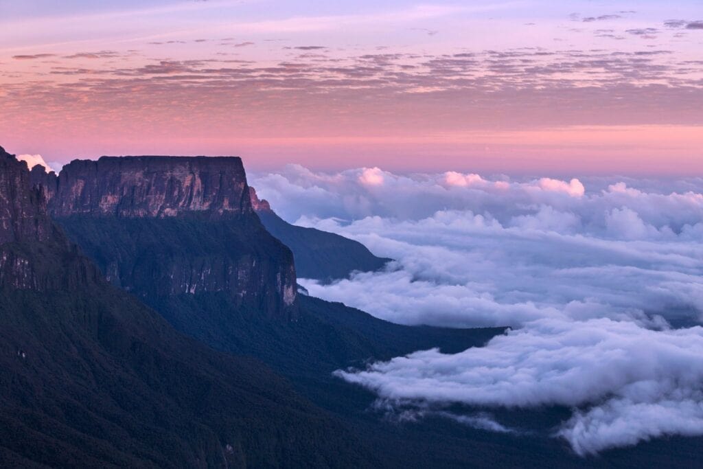
Mount Roraima is located in western Guyana, near the boundary between Brazil and Venezuela. It is located at an elevation of 2 810 metres (9 219 feet). Mount Roraima, first ascended successfully by Everard F Im Thurn and Harry Inniss Perkins in 1884, is still a popular hiking destination. It is the tallest mountain in Brazil in the Tepui Plateau's Pakaraima series, which is part of the Guiana Highlands.
5. Pico Da Bandeira
Pico da Bandeira is the third highest point in brazil with a peak elevation of 9,488 feet. The mountain is located on the boundary of the states of Minas Gerais and Espirito Santo. The mountain is easily accessible and a popular tourist attraction. It is located within Caparao National Park. The park is home to a variety of wildlife, including jaguars, deer, tapirs, and black-fronted piping guans. There is also a large area of Atlantic woodland in the area.
6. Morro Da Igreja
Morro da Igreja, or Church Hill, is regarded as the coldest spot in Brazil and is frequently visited by visitors, particularly during the winter, when temperatures are consistently negative. The Church Hill is a peak in southern Brazil, in the chilly and southeastern state of Santa Catarina, specifically in the Sierra Geral range, near the city of Urubici. The top, at 1.822m, is the highest inhabited point in the southern area, and it was here that the lowest temperature ever recorded in Brazil, 17.8°C on June 29, 1996, was unofficially reported as 17.8°C.
7. Pico Das Agulhas Negras
Pico das Agulhas Negras is Brazil's fifth tallest mountain range, reaching 2,791 metres (9,157 feet) above sea level and ranking among the highest in the Brazilian Highlands. It is located in Itatiaia National Park, in the Serra da Mantiqueira mountain range, on the border of the states of Rio de Janeiro and Minas Gerais. One of the highest points of the Rio de Janeiro mountains and the third highest peak in Minas Gerais range.
8. Pico Do Calcado
Pico do Calcado, at 2821 metres, is one of the most famous mountains in Brazil. This is an unidentified summit since it connects Pico da Bandeira (2894m) with Pico do Cristal (2798m), and many are unaware of its significance. Pico do Calcado has a rounded shape, no climbing paths, and just rocks and little vegetation at the top, indicating its high tropical altitude. This is a simple mountain with a moderate walk up and well-marked routes to the summit. September is the finest month to visit Caparo National Park and walk the high routes. This is the driest month of the year. However, April has here, and the winters have been spectacular as usual.
9. Pedra da Mina
This mountain range is the tallest in So Paulo and is part of Brazil's most major mountain range, the Mantiqueira mountains. It also has a reputation for being one of the most difficult to climb due to its isolated position, rough topography, and placement in a chilly zone. What distinguishes it? It features four creeks of spring water that run around the summit of the mountain, and its southern slope is a private farm and nature reserve, so part of it is off-limits.
10. Corcovado Mountain

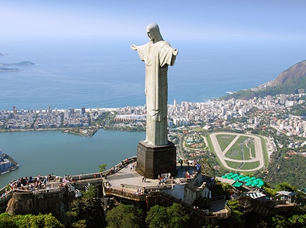
Corcovado Mountain looms above Rio de Janeiro, Brazil's lively capital. The peak was once known as Pinaculo da Tentacao, which translates to "Pinnacle of Temptation." This has Biblical references and was chosen centuries ago by Portuguese immigrants. It was then dubbed Corcovado, which relates to its hunchback form. The Corcovado and the statue are sometimes confused, although the one is the name of a rocky mountain in the city centre, while the second is a piece of art. To use the Corcovado to refer to the statue is thus an error, which is all too common.
The Corcovado is a symbol of Rio de Janeiro, as is the sugar loaf, which is considerably smaller. But if the sugar loaf is so well-known, it is because of its unique shape and position, which is on the lake and separated from the other peaks in the vicinity. The Corcovado, on the other side, lies significantly further inland and stands out less.
Brazil's mountains are attractive and breathtaking. Visitors can participate in a variety of leisure activities. Pack your bags, schedule your trip to Brazil with Veena World, and enjoy the breathtaking mountains!











Post your Comment
Please let us know your thoughts on this story by leaving a comment.